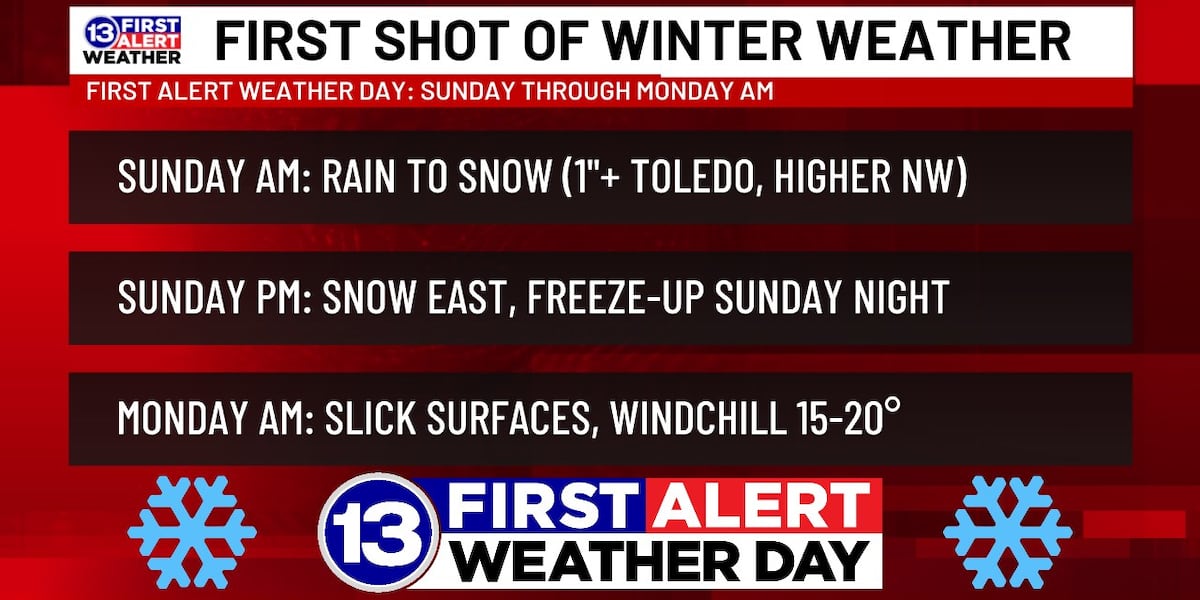
The 13 First Alert Weather Team has declared a First Alert Weather Day, starting early Sunday AM and running through Monday AM.
This is in light of the newest data this afternoon edging slushy snow accumulations closer to Toledo, AND nudging totals up for NW counties (2-3″ possible).
It will all start as rain late Saturday night, switching to steady snow Sunday AM, mainly NW of the Maumee River as the low treks over us. A few snowflakes and raindrops may linger into Sunday PM. Later that evening, lake-effect snow showers will restart east of I-75. Overnight into Monday AM, temps will dip to the mid-20s, so whatever water remains on the roads may lead to slick spots. A northwesterly breeze in the wake of that system will make it feel closer to 15-20° to start the new work week.
Initially much of the snow will melt on contact, especially with roads. Eventually, accumulations are possible, especially on grassy areas and elevated surfaces. Totals of a coating to 1″+ are likely on Sunday for areas along and west of I-75, and 2-3″ is possible north and west of Toledo. Meanwhile, our eastern counties may see little to no accumulation on Sunday, but light totals will be possible from lake-effect snow showers Sunday night into Monday.
Stay with 13abc as we take you through Old Man Winter’s first visit of the season to NW Ohio/SE Michigan.
Latest Local News | First Alert Weather | Crime | National | 13abc Originals
Copyright 2025 WTVG. All rights reserved.

This article was published by WTVG on 2025-11-07 16:46:00
View Original Post


